Council District 42
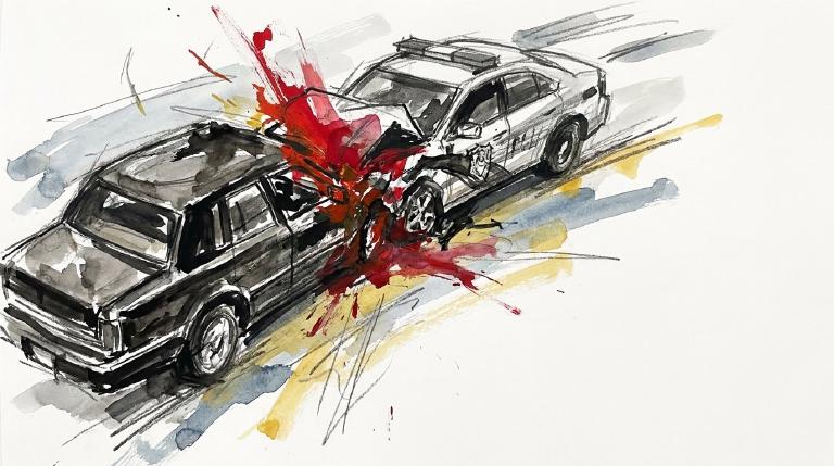
Crash Narratives
Council District 42 turns loud after midnight
Three crashes in seven days left one person dead and three seriously hurt in District 42.
- 3 crashes in last 7 days
- 3 serious injuries
- 1 death
- Just after midnight on Linden Blvd, a driver in an SUV hit a motorcycle rider. Police recorded the rider was ejected and killed.
- Police recorded driver inattention after a driver hit a moped rider on New Lots Avenue at Wyona Street. A 35-year-old man reported internal injuries and shoulder/upper-arm trauma.
- A 15-year-old boy ended up with severe leg lacerations after a motorcycle rider hit him near 2202 Linden Boulevard. Police recorded pedestrian error/confusion.
Two drivers collide on Church Ave
A driver on Church Avenue hit another driver near Ralph Avenue. Both men were hurt, one with internal injuries and one with a bleeding face.
Council District 42: Traffic Crash Statistics
Crash Counter for District 42 906 crashes • 4 deaths
About these crash totals
Counts come from NYC police crash reports (NYPD Motor Vehicle Collisions on NYC Open Data). We sum all crashes, injuries, and deaths for this area across the selected time window shown on the card. Injury severity follows DOT's KABCO definitions mapped from the NYPD Person table (injury status, injury type, and injury location).
- Crashes: number of police‑reported collisions (all road users).
- All injuries: people with any reported injury (KABCO A/B/C or generic "injured").
- Moderate / Serious: suspected minor + suspected serious injuries (KABCO B + A).
- Deaths: killed or apparent death reported by police (KABCO K).
Change badges (arrows and percentages) compare the selected window with the same period last year whenever we have enough history. The “From 2022” view shows totals across the full span since 2022. When a comparison window isn’t available the badge shows an em dash.
Notes: Police reports can be corrected after initial publication. We cannot verify "death within 30 days" or hospital outcomes, so small differences from DOT totals are possible. Minor incidents without a police report are not included.
CloseCaught Speeding in CD 42 V87WEM — 52 times
- 52 speed-camera tickets citywide in 12 monthsNJ V87WEM · 2023 BMW Seda
- 20 speed-camera tickets citywide in 12 monthsNY IMLOYAL2 · 2025 White Me/Be Suburban
- 18 speed-camera tickets citywide in 12 monthsPA MYW0466 · 2021 Lexus Sedan
- 18 speed-camera tickets citywide in 12 monthsNY LHZ5251 · 2024 Red Nissan Suburban
- 18 speed-camera tickets citywide in 12 monthsNY LUL5288 · 2025 Gr Honda Suburban
About this list
This ranks vehicles caught speeding in this area during the latest 12-month window by the number of NYC school-zone speed-camera violations they received anywhere in the city during that same window.
Camera violations are issued by NYC DOT’s program. Counts reflect issued tickets and may omit dismissed or pending cases. Plate text is shown verbatim as recorded.
CloseDangerous Schools in CD 42 Loading school hotspots...
| School | Crashes
Injuries
Child injuries
Deaths |
|---|
Dangerous Streets in CD 42 Loading street hotspots...
| Street | Crashes
Injuries
Child injuries
Deaths |
|---|
Dangerous Intersections in CD 42 Loading intersection hotspots...
| Intersection | Crashes
Injuries
Child injuries
Deaths |
|---|
Crash Finder
Try Crash Finder
Look up any street, school, address, or intersection to see how safe the streets are.
CD 42 Hot Spots Danger zones and recent crashes
Traffic Safety Timeline Tap to view recent events
Carnage in CD 42 8 Minor Bleeding (Head)
▸ Killed 4
▸ Crush Injuries 3
▸ Severe Bleeding 3
▸ Severe Lacerations 1
▸ Concussion 4
▸ Fracture/Dislocation 5
▸ Internal Injury 12
▸ Whiplash 18
▸ Contusion/Bruise 28
▸ Abrasion 20
▸ Pain/Nausea 6
Crashes by Hour in CD 42 5 PM • 43 injuries ↑39%
Who is getting hurt? Kids 59 injuries ↓16% Seniors 40 injuries ↑2.6%
Toggle on at least one mode to see people totals.
Totals count people injured or killed. Use the mode filters above to focus the stacks.
Dangerous Bike Lanes in CD 42 Loading bike lane hotspots...
| Bike lane | Crashes
Cyclist injuries
Child injuries
Cyclist deaths |
|---|
What Crashes Cost Here Loading estimate...
Loading crash cost estimate...
The three blocks below show direct costs, other harm, and the total for crashes with injuries, crashes without injuries, and all crashes together.
How we calculate this
We calculate these costs using a method developed by the National Highway Traffic Safety Administration, or NHTSA. It gives one set of costs for crashes with injuries and another for crashes with no reported injuries.
Crashes with injuries cost much more because the method includes things like lost work, medical care, and long-term harm. NHTSA says crash costs include "lost productivity, medical, legal and court costs, emergency service, insurance administration, congestion, property damage, and workplace losses."
These are estimates, not bills. "Other harm" is the part of the broader estimate that goes beyond direct bills and insurance claims. It captures pain, disability, and lost quality of life.
Download the math (CSV) · Download the math (JSON) · Method and sources
Preventable Speeding 5,427 16+ offenders ↓71%
Repeat School-Zone Speeding Offenders
- ≥ 6: 10,977 (2026 year-to-date) • Prev: 36,848 2025 year-to-date
- ≥ 16: 5,427 (2026 year-to-date) • Prev: 18,657 2025 year-to-date
Pedestrian Injuries 99% by Cars and Trucks ↑7.6%
About this chart
We group pedestrian injuries and deaths by the vehicle type that struck them (as recorded in police reports). Use the year selector to compare the current window with the prior period.
- Trucks/Buses, SUVs/Cars, Mopeds, and Bikes reflect the broad categories we use to track vehicle harm.
- Counts include people on foot only; crashes with no injured pedestrians do not appear in this card.
Notes: Police classification can change during investigations. Small categories may have year-to-year variance.
CloseCouncil Member Chris Banks D (52)

District 42
- 2024-12-19 · Sponsor · NYC Council – Legistar · ↓ hurts gradeCouncil bill targets speed. Shared e-bikes and scooters must have speedometers. New riders get capped at 10 mph. Law aims to slow the city’s fastest wheels. Committee review underway.
- 2024-12-19 · Vote · NYC Council – Legistar · ↓ hurts gradeBanks votes yes on bill requiring FDNY consultation for street projects.
- 2024-12-19 · Vote · NYC Council – Legistar · ↓ hurts gradeBanks votes yes on bill requiring FDNY consultation for street projects.
- 2024-11-13 · Sponsor · NYC Council – Legistar · ↑ helps gradeCouncil demands DOT show its work. The law forces public updates on every street safety project. No more hiding delays. No more silent cost overruns. Progress for bus riders, cyclists, and walkers must be tracked and posted.
- 2024-06-06 · Vote · NYC Council – Legistar · ↑ helps gradeCouncil calls for five mile per hour speed limit on Open Streets. Streets slow. Danger drops. Pedestrians and cyclists get space. Resolution adopted. Albany must act.
- 2024-05-16 · Sponsor · NYC Council – Legistar · ↑ helps gradeCouncil moves to light up step streets. At least 25 stairways each year will get new lamps. Dark paths become visible. Pedestrians gain ground. Shadows shrink. Danger loses its cover.
- 👎 Negative2024-05-16 · Sponsor · NYC Council – Legistar · ↓ hurts gradeCouncil bill targets repeat pedal-assist bike violators. Three strikes trigger a mandatory safety course. Ignore the course, lose your bike. DOT will track results. Three-year pilot. Enforcement, not education, leads.
- 2024-03-19 · Sponsor · NYC Council – LegistarCouncil wants bold signs at every school entrance. Paint on pavement. Metal overhead. The aim: warn drivers, shield kids. The bill sits in committee. Streets wait. Danger does not.
- 2025-11-25 · Sponsor · NYC Council – LegistarCouncil orders DOT to study Harlem River ferry growth. West Bronx in focus. Report due in a year. Transit gaps choke streets; ferries could shift trips off deadly roads.
- 2025-11-25 · Sponsor · NYC Council – LegistarBanks co-sponsors Inwood ferry feasibility study, neutral safety impact.
- 2025-10-29 · Sponsor · NYC Council – Legistar · ↓ hurts gradeCouncil bill would cap the clear pedestrian path in front of sidewalk cafes at eight feet. Introduced and sent to the Committee on Transportation and Infrastructure on Oct. 29, 2025. The change narrows walking space and raises conflict risk for pedestrians and cyclists.
- 2025-10-29 · Sponsor · NYC Council – LegistarInt 1446-2025 forces DOT to accept sidewalk and roadway cafe applications online and at public locations. Applicants can save drafts. It bars mandatory professional drawing approval while preserving DOT review of required clearances.
- 2025-05-28 · Sponsor · NYC Council – Legistar · ↑ helps gradeCouncil pushes a bill to cut bike share costs for New Yorkers over 65. The measure aims to open city cycling to more seniors. The committee now weighs its next move.
- 2025-05-28 · Sponsor · NYC Council – Legistar · ↑ helps gradeCouncil bill pushes for discounted bike share rates for New Yorkers 65 and up. The move aims to open city streets to older riders. The measure sits with the Transportation Committee. No safety review yet.
- 2025-05-28 · Sponsor · NYC Council – Legistar · ↑ helps gradeCouncil pushes bill for cheaper bike share for New Yorkers over 65. More seniors could ride. The city’s streets may see older cyclists in the mix. The committee now holds the bill.
- 2025-05-28 · Sponsor · NYC Council – Legistar · ↑ helps gradeCouncil pushes cheaper bike share for seniors. More elders could ride. Streets may see more slow, unprotected cyclists. Danger from cars remains. Bill sits in committee. No safety fixes for traffic threats.
- 2026-04-30 · Sponsor · NYC Council – LegistarInt 0866-2026 targets surprise street upheaval. It orders DOT to post warning signs near long disruptions. Closures, reroutes, and station moves would have a clock and a contact.
- 👎 Negative2026-02-24 · Sponsor · NYC Council – Legistar · ↓ hurts gradeInt 0688-2026 would tie street-closure permits to no-standing zones on nearby blocks, pushing detouring buses and trucks through cleared curb space. It sits in the Transportation and Infrastructure Committee.
- 2026-02-24 · Sponsor · NYC Council – Legistar · ↓ hurts gradeInt 0688-2026 would tie street-closure permits to temporary no-standing zones on nearby blocks. It aims to clear detours for buses and trucks. Permit holders would post notice as changes take effect.
- 2026-02-24 · Leadership · NYC Council – Legistar · ↓ hurts gradeA street closes. Trucks and buses spill onto side blocks. Int 0688-2026 would force temporary no-standing zones and public notice, shifting curb space fast during detours.
1199 Elton Street, Brooklyn, NY 11207
718-649-9495
250 Broadway, Suite 1774, New York, NY 10007
212-788-6957
Borough President Antonio Reynoso —
Police Precinct NYPD 75th Precinct —
Other Geographies See nearby areas
▸ Other Geographies
District 42 Council District 42 sits in Brooklyn, Precinct 75.
It contains Brooklyn CB 5, Brooklyn CB 56, East New York (North), East New York-New Lots, Spring Creek-Starrett City, East New York-City Line, East Flatbush-Remsen Village, Jamaica Bay (West), Shirley Chisholm State Park.
▸ See also
