Council District 10
Crash Narratives
Council District 10: Traffic Crash Statistics
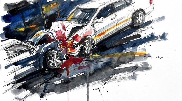
Crash Counter for District 10 1,185 crashes • 7 deaths
About these crash totals
Counts combine NYC police crash reports (NYPD Motor Vehicle Collisions on NYC Open Data) with CrashCount-reviewed press-confirmed fatal crashes that are awaiting or not yet matched to police records. We sum crashes, injuries, and deaths for this area across the selected time window shown on the card. Injury severity follows DOT's KABCO definitions mapped from the NYPD Person table (injury status, injury type, and injury location) when a police record is available.
- Crashes: police-reported collisions plus reviewed press-confirmed fatal crashes (all road users).
- All injuries: people with any reported injury (KABCO A/B/C or generic "injured").
- Moderate / Serious: suspected minor + suspected serious injuries (KABCO B + A).
- Deaths: killed or apparent death reported by police (KABCO K), plus fatalities confirmed in reviewed press reports before a police record is matched.
Change badges (arrows and percentages) compare the selected window with the same period last year whenever we have enough history. The “From 2022” view shows totals across the full span since 2022. When a comparison window isn’t available the badge shows an em dash.
Notes: Police reports and press-first fatal crash records can be corrected after initial publication. When a press-first record is later matched to a police collision record, CrashCount uses the matched record instead of counting it twice. We cannot verify "death within 30 days" or hospital outcomes, so small differences from DOT totals are possible. Minor incidents without a police report or reviewed fatal press report are not included.
CloseCaught Speeding in CD 10 KXM7078 — 270 times
- 270 speed-camera tickets citywide in 12 monthsNY KXM7078 · 2022 Gray Ford PickupCaught here 1 time in the last 12 months.Typically speeds citywide in: Crown Heights (North) (24), Brownsville (13), and Ocean Hill (12).
- 221 speed-camera tickets citywide in 12 monthsNY LHW6019 · 2024 Gray Toyota SedanCaught here 1 time in the last 12 months.Typically speeds citywide in: Crown Heights (North) (14), East New York (North) (11), and Ocean Hill (11).
- 217 speed-camera tickets citywide in 12 monthsNY LHW5598 · 2023 Black Toyota SedanCaught here 1 time in the last 12 months.Typically speeds citywide in: Fordham Heights (23), Mount Hope (19), and Concourse-Concourse Village (16).
- 202 speed-camera tickets citywide in 12 monthsNY LNY5105 · 2024 Black Toyota PickupCaught here 3 times in the last 12 months.Typically speeds citywide in: East New York (North) (11), Eastchester-Edenwald-Baychester (11), and East Flatbush-Rugby (10).
- 187 speed-camera tickets citywide in 12 monthsNY LHW6270 · 2024 Black Toyota SedanCaught here 1 time in the last 12 months.Typically speeds citywide in: East New York (North) (22), East New York-New Lots (20), and Cypress Hills (15).
About this list
This ranks vehicles caught speeding in this area during the latest 12-month window by the number of NYC school-zone speed-camera violations they received anywhere in the city during that same window.
Camera violations are issued by NYC DOT’s program. Counts reflect issued tickets and may omit dismissed or pending cases. Plate text is shown verbatim as recorded.
CloseDangerous Schools in CD 10 Loading school hotspots...
| School | Crashes
Injuries
Child injuries
Deaths |
|---|
Dangerous Streets in CD 10 Loading street hotspots...
| Street | Crashes
Injuries
Child injuries
Deaths |
|---|
Dangerous Intersections in CD 10 Loading intersection hotspots...
| Intersection | Crashes
Injuries
Child injuries
Deaths |
|---|
Crash Finder
Try Crash Finder
Look up any street, school, address, or intersection to see how safe the streets are.
CD 10 Hot Spots Danger zones and recent crashes
Traffic Safety Timeline Tap to view recent events
Carnage in CD 10 17 Contusion/Bruise (Lower leg/foot)
▸ Killed 7
▸ Crush Injuries 5
▸ Severe Bleeding 6
▸ Severe Lacerations 8
▸ Concussion 6
▸ Fracture/Dislocation 15
▸ Internal Injury 4
▸ Whiplash 24
▸ Contusion/Bruise 46
▸ Abrasion 18
▸ Pain/Nausea 25
Crashes by Hour in CD 10 9 AM • 41 injuries ↑105%
Who is getting hurt? Kids 55 injuries ↑12% Seniors 60 injuries ↑46%
Toggle on at least one mode to see people totals.
Totals count people injured or killed. Use the mode filters above to focus the stacks.
Dangerous Bike Lanes in CD 10 Loading bike lane hotspots...
| Bike lane | Crashes
Cyclist injuries
Child injuries
Cyclist deaths |
|---|
What Crashes Cost Here Loading estimate...
Loading crash cost estimate...
The three blocks below show direct costs, other harm, and the total for crashes with injuries, crashes without injuries, and all crashes together.
How we calculate this
We calculate these costs using a method developed by the National Highway Traffic Safety Administration, or NHTSA. It gives one set of costs for crashes with injuries and another for crashes with no reported injuries.
Crashes with injuries cost much more because the method includes things like lost work, medical care, and long-term harm. NHTSA says crash costs include "lost productivity, medical, legal and court costs, emergency service, insurance administration, congestion, property damage, and workplace losses."
These are estimates, not bills. "Other harm" is the part of the broader estimate that goes beyond direct bills and insurance claims. It captures pain, disability, and lost quality of life.
Download the math (CSV) · Download the math (JSON) · Method and sources
Preventable Speeding 3,460 16+ offenders ↑65%
Repeat School-Zone Speeding Offenders
- ≥ 6: 9,583 (2026 year-to-date) • Prev: 6,003 2025 year-to-date
- ≥ 16: 3,460 (2026 year-to-date) • Prev: 2,098 2025 year-to-date
Pedestrian Injuries 96% by Cars and Trucks ↓4.2%
About this chart
We group pedestrian injuries and deaths by the vehicle type that struck them (as recorded in police reports). Use the year selector to compare the current window with the prior period.
- Trucks/Buses, SUVs/Cars, Mopeds, and Bikes reflect the broad categories we use to track vehicle harm.
- Counts include people on foot only; crashes with no injured pedestrians do not appear in this card.
Notes: Police classification can change during investigations. Small categories may have year-to-year variance.
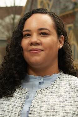
CloseCouncil Member Carmen N. De La Rosa D (63)*
District 10
- 2024-12-19 · Sponsor · NYC Council – Legistar · ↑ helps gradeCouncil moves to test bold pavement markings at crash sites. Five spots per borough. Focus: places where drivers have killed or maimed. Report to follow. Streets marked for danger.
- 2024-12-19 · Vote · NYC Council – Legistar · ↓ hurts gradeDe La Rosa votes yes on bill requiring FDNY consultation for street projects.
- 2024-12-19 · Vote · NYC Council – Legistar · ↓ hurts gradeDe La Rosa votes yes on bill requiring FDNY consultation for street projects.
- 2024-12-05 · Sponsor · NYC Council – Legistar · ↑ helps gradeCouncil bill bars cars from blocking crosswalks. No standing or parking within 20 feet. City must install daylighting barriers at 1,000 intersections yearly. Streets clear. Sightlines open. Danger cut.
- 2024-09-26 · Vote · NYC Council – Legistar · ↑ helps gradeCouncil ends jaywalking penalties. Pedestrians now cross anywhere, any time. No summons. Law strips drivers of excuses. Streets shift. Power tilts to people on foot.
- 2024-09-10 · Vote · NYC Council – Legistar · ↑ helps gradeCouncil ends jaywalking penalties. Pedestrians now cross anywhere, any time. No summons. Law strips drivers of excuses. Streets shift. Power tilts to people on foot.
- 2024-08-15 · Vote · NYC Council – LegistarCity law now forces DOT to reveal where bikes and scooters go. Streets and bridges, protected or not. Data goes public. Riders’ movement, danger, and safety projects laid bare. No more hiding the facts.
- • Neutral2024-08-15 · Vote · NYC Council – LegistarCity law now forces DOT to reveal where bikes and scooters go. Streets and bridges, protected or not. Data goes public. Riders’ movement, danger, and safety projects laid bare. No more hiding the facts.
- 2025-11-25 · Sponsor · NYC Council – LegistarCouncil orders DOT to study Harlem River ferry growth. West Bronx in focus. Report due in a year. Transit gaps choke streets; ferries could shift trips off deadly roads.
- 2025-11-25 · Sponsor · NYC Council – LegistarInt 1492 orders a one-year feasibility study to expand ferry service along the Harlem River, with focus on the West Bronx. It will map sites, costs, and navigational hurdles. The study itself changes no streets; future impacts on walkers and cyclists depend on design.
- 2025-11-25 · Sponsor · NYC Council – LegistarDe La Rosa co-sponsors Inwood ferry feasibility study, neutral safety impact.
- 2025-11-25 · Sponsor · NYC Council – LegistarDe La Rosa co-sponsors Inwood ferry feasibility study and report bill.
- 👍 Positive2025-10-29 · Sponsor · NYC Council – Legistar · ↑ helps gradeInt 1439-2025 would require the NYPD to assign at least one crossing guard to every public and private K–8 school by Sept. 1, 2026. It places an adult between traffic and children at arrival and dismissal, changing street interactions around schools.
- 2025-10-09 · Sponsor · NYC Council – Legistar · ↑ helps gradeInt. 1421-2025 would widen outdoor dining: let grocery stores apply for sidewalk licenses, allow roadway cafes year-round, expand frontage for some cafes, and speed approvals. Committee laid it over on Nov. 24, 2025.
- 2025-10-09 · Sponsor · NYC Council – LegistarInt 1421-2025 would let restaurants and grocery stores run sidewalk and roadway cafes in curb or parking lanes year‑round. It speeds reviews, sets $1,050 fees and four‑year terms, and pushes dining closer to moving traffic — raising risks for pedestrians and cyclists.
- 2025-10-09 · Sponsor · NYC Council – Legistar · ↓ hurts gradeExpanding sidewalk and roadway cafes increases sidewalk obstructions and consumes curb space needed for protected bike lanes and loading, likely pushing stopping and deliveries into bike lanes and elevating conflict risk. While some traffic calming may occur, the legislation lacks firm guarantees for clear pedestrian paths or bike protection, shifting burdens onto vulnerable users.
- 2026-10-02 · Leadership · Streetsblog NYC · ↓ hurts gradeA push grew to let cars back into Quisqueya Plaza. Electeds and merchants pressed DOT for a redesign. Residents fought to keep the refuge. For now it’s talk, not asphalt.
- 2026-02-12 · Leadership · NYC Council – Legistar · ↑ helps gradeInt 0528-2026 moved to Public Safety committee. It hikes penalties for illegal ATVs and dirt bikes. The city targets repeat riding with steeper dollar hits.
- 2026-02-12 · Leadership · NYC Council – Legistar · ↑ helps gradeInt 0528-2026 moved to Public Safety committee. It hikes penalties for illegal ATVs and dirt bikes. The city targets repeat riding with steeper dollar hits.
- 2026-02-12 · Sponsor · NYC Council – Legistar · ↑ helps gradeInt 0528-2026 moved to Public Safety committee. It hikes penalties for illegal ATVs and dirt bikes. The city targets repeat riding with steeper dollar hits.
- 2026-10-02 · Leadership · Streetsblog NYC · ↓ hurts gradeA push grew to let cars back into Quisqueya Plaza. Electeds and merchants pressed DOT for a redesign. Residents fought to keep the refuge. For now it’s talk, not asphalt.
- 2026-02-12 · Leadership · NYC Council – Legistar · ↑ helps gradeInt 0528-2026 moved to Public Safety committee. It hikes penalties for illegal ATVs and dirt bikes. The city targets repeat riding with steeper dollar hits.
- 2026-02-12 · Leadership · NYC Council – Legistar · ↑ helps gradeInt 0528-2026 moved to Public Safety committee. It hikes penalties for illegal ATVs and dirt bikes. The city targets repeat riding with steeper dollar hits.
- 2026-02-12 · Sponsor · NYC Council – Legistar · ↑ helps gradeInt 0528-2026 moved to Public Safety committee. It hikes penalties for illegal ATVs and dirt bikes. The city targets repeat riding with steeper dollar hits.
618 W. 177th Street, Ground Floor, New York, NY 10033
917-521-2616
250 Broadway, Suite 1880, New York, NY 10007
212-788-7053
Borough President Brad Hoylman-Sigal —
Police Precinct NYPD 34th Precinct —
Other Geographies See nearby areas
▸ Other Geographies
District 10 Council District 10 sits in Manhattan, Precinct 34.
It contains Manhattan CB 12, Kingsbridge-Marble Hill, Washington Heights (South), Washington Heights (North), Inwood, Highbridge Park, Inwood Hill Park.