Manhattan Community Board 11
Crash Narratives
Manhattan Community Board 11: Traffic Crash Statistics
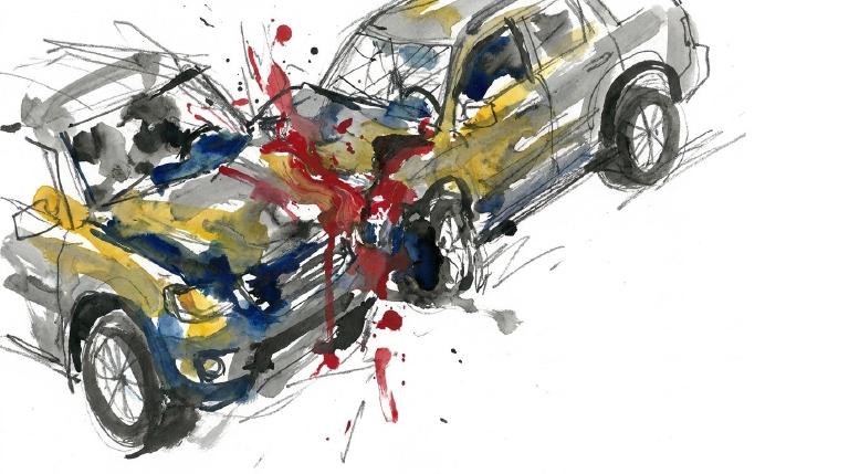
Crash Counter for Manhattan CB11 1,390 crashes • 1 deaths
About these crash totals
Counts combine NYC police crash reports (NYPD Motor Vehicle Collisions on NYC Open Data) with CrashCount-reviewed press-confirmed fatal crashes that are awaiting or not yet matched to police records. We sum crashes, injuries, and deaths for this area across the selected time window shown on the card. Injury severity follows DOT's KABCO definitions mapped from the NYPD Person table (injury status, injury type, and injury location) when a police record is available.
- Crashes: police-reported collisions plus reviewed press-confirmed fatal crashes (all road users).
- All injuries: people with any reported injury (KABCO A/B/C or generic "injured").
- Moderate / Serious: suspected minor + suspected serious injuries (KABCO B + A).
- Deaths: killed or apparent death reported by police (KABCO K), plus fatalities confirmed in reviewed press reports before a police record is matched.
Change badges (arrows and percentages) compare the selected window with the same period last year whenever we have enough history. The “From 2022” view shows totals across the full span since 2022. When a comparison window isn’t available the badge shows an em dash.
Notes: Police reports and press-first fatal crash records can be corrected after initial publication. When a press-first record is later matched to a police collision record, CrashCount uses the matched record instead of counting it twice. We cannot verify "death within 30 days" or hospital outcomes, so small differences from DOT totals are possible. Minor incidents without a police report or reviewed fatal press report are not included.
CloseCaught Speeding in CB 111 KXM7078 — 270 times
- 270 speed-camera tickets citywide in 12 monthsNY KXM7078 · 2022 Gray Ford PickupCaught here 2 times in the last 12 months.Typically speeds citywide in: Crown Heights (North) (24), Brownsville (13), and Ocean Hill (12).
- 202 speed-camera tickets citywide in 12 monthsNY LNY5105 · 2024 Black Toyota PickupCaught here 1 time in the last 12 months.Typically speeds citywide in: East New York (North) (11), Eastchester-Edenwald-Baychester (11), and East Flatbush-Rugby (10).
- 182 speed-camera tickets citywide in 12 monthsNY KZF9979 · 2023 Black Mitsubishi SuburbanCaught here 1 time in the last 12 months.Typically speeds citywide in: Fordham Heights (32), Bedford Park (18), and Concourse-Concourse Village (12).
- 169 speed-camera tickets citywide in 12 monthsNY LHW5596 · 2023 Gray Toyota SedanCaught here 1 time in the last 12 months.Typically speeds citywide in: Crown Heights (North) (22), East New York-New Lots (21), and East New York (North) (20).
- 160 speed-camera tickets citywide in 12 monthsNY KXH2766 · 2022 Gray Kia SedanCaught here 1 time in the last 12 months.Typically speeds citywide in: Tompkinsville-Stapleton-Clifton-Fox Hills (43), Mariner's Harbor-Arlington-Graniteville (21), and West New Brighton-Silver Lake-Grymes Hill (17).
About this list
This ranks vehicles caught speeding in this area during the latest 12-month window by the number of NYC school-zone speed-camera violations they received anywhere in the city during that same window.
Camera violations are issued by NYC DOT’s program. Counts reflect issued tickets and may omit dismissed or pending cases. Plate text is shown verbatim as recorded.
CloseDangerous Schools in CB 111 Loading school hotspots...
| School | Crashes
Injuries
Child injuries
Deaths |
|---|
Dangerous Streets in CB 111 Loading street hotspots...
| Street | Crashes
Injuries
Child injuries
Deaths |
|---|
Dangerous Intersections in CB 111 Loading intersection hotspots...
| Intersection | Crashes
Injuries
Child injuries
Deaths |
|---|
Crash Finder
Try Crash Finder
Look up any street, school, address, or intersection to see how safe the streets are.
CB 111 Hot Spots Danger zones and recent crashes
Traffic Safety Timeline Tap to view recent events
Carnage in CB 111 25 Whiplash (Neck)
▸ Killed 1
▸ Crush Injuries 3
▸ Amputation 2
▸ Severe Bleeding 4
▸ Severe Lacerations 5
▸ Concussion 4
▸ Fracture/Dislocation 10
▸ Internal Injury 10
▸ Whiplash 77
▸ Contusion/Bruise 39
▸ Abrasion 39
▸ Pain/Nausea 30
Crashes by Hour in CB 111 2 PM • 56 injuries ↑30%
Who is getting hurt? Kids 76 injuries ↑29% Seniors 49 injuries ↓22%
Toggle on at least one mode to see people totals.
Totals count people injured or killed. Use the mode filters above to focus the stacks.
Dangerous Bike Lanes in CB 111 Loading bike lane hotspots...
| Bike lane | Crashes
Cyclist injuries
Child injuries
Cyclist deaths |
|---|
What Crashes Cost Here Loading estimate...
Loading crash cost estimate...
The three blocks below show direct costs, other harm, and the total for crashes with injuries, crashes without injuries, and all crashes together.
How we calculate this
We calculate these costs using a method developed by the National Highway Traffic Safety Administration, or NHTSA. It gives one set of costs for crashes with injuries and another for crashes with no reported injuries.
Crashes with injuries cost much more because the method includes things like lost work, medical care, and long-term harm. NHTSA says crash costs include "lost productivity, medical, legal and court costs, emergency service, insurance administration, congestion, property damage, and workplace losses."
These are estimates, not bills. "Other harm" is the part of the broader estimate that goes beyond direct bills and insurance claims. It captures pain, disability, and lost quality of life.
Download the math (CSV) · Download the math (JSON) · Method and sources
Preventable Speeding 610 16+ offenders ↓26%
Repeat School-Zone Speeding Offenders
- ≥ 6: 1,689 (2026 year-to-date) • Prev: 2,156 2025 year-to-date
- ≥ 16: 610 (2026 year-to-date) • Prev: 823 2025 year-to-date
Pedestrian Injuries 99% by Cars and Trucks ↓9.5%
About this chart
We group pedestrian injuries and deaths by the vehicle type that struck them (as recorded in police reports). Use the year selector to compare the current window with the prior period.
- Trucks/Buses, SUVs/Cars, Mopeds, and Bikes reflect the broad categories we use to track vehicle harm.
- Counts include people on foot only; crashes with no injured pedestrians do not appear in this card.
Notes: Police classification can change during investigations. Small categories may have year-to-year variance.
CloseCommunity Board Contact Adem Brija —
Community Board Contact Adem Brija
District 111
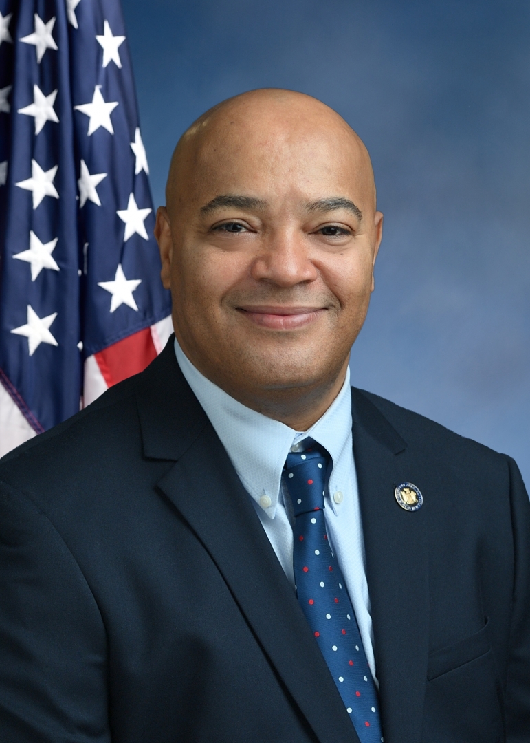
Assembly Member Eddie Gibbs C (77)*
District 68
- 2022-06-02 · Vote · Open States · ↑ helps gradeSenate passed S 5602 to keep school zone speed cameras running longer. More eyes on reckless drivers. Lawmakers push back against speeding near kids. The vote was clear. The danger remains.
- 2022-05-31 · Vote · Open States · ↓ hurts gradeAssembly and Senate passed A 8933. The bill shields emergency vehicle operators from fines for traffic violations during medical calls. Vulnerable road users face more risk. Accountability weakens. Streets grow more dangerous.
- 2022-05-31 · Vote · Open States · ↓ hurts gradeAssembly and Senate passed A 8933. The bill shields emergency vehicle operators from fines for traffic violations during medical calls. Vulnerable road users face more risk. Accountability weakens. Streets grow more dangerous.
- 2022-05-25 · Vote · Open States · ↑ helps gradeSenate passed S 5602 to keep school zone speed cameras running longer. More eyes on reckless drivers. Lawmakers push back against speeding near kids. The vote was clear. The danger remains.
- 2022-06-02 · Vote · Open States · ↑ helps gradeSenate passed S 5602 to keep school zone speed cameras running longer. More eyes on reckless drivers. Lawmakers push back against speeding near kids. The vote was clear. The danger remains.
- 2022-05-31 · Vote · Open States · ↓ hurts gradeAssembly and Senate passed A 8933. The bill shields emergency vehicle operators from fines for traffic violations during medical calls. Vulnerable road users face more risk. Accountability weakens. Streets grow more dangerous.
- 2022-05-31 · Vote · Open States · ↓ hurts gradeAssembly and Senate passed A 8933. The bill shields emergency vehicle operators from fines for traffic violations during medical calls. Vulnerable road users face more risk. Accountability weakens. Streets grow more dangerous.
- 2022-05-25 · Vote · Open States · ↑ helps gradeSenate passed S 5602 to keep school zone speed cameras running longer. More eyes on reckless drivers. Lawmakers push back against speeding near kids. The vote was clear. The danger remains.
- 2023-07-31 · Leadership · Streetsblog NYC · ↓ hurts gradeManhattan lawmakers want electric cars to pay less under congestion pricing. They argue EVs cut smog, so drivers deserve a break. Critics warn this move keeps streets clogged. Fewer cars mean fewer crashes. The fight pits clean air against crowded roads.
- 2023-06-06 · Vote · Open States · ↑ helps gradeAlbany gets speed cameras near schools. Lawmakers pass A 7043. Cameras catch drivers who endanger kids. The program runs until 2028. Streets near schools face new watchful eyes.
- 2023-06-06 · Vote · Open States · ↑ helps gradeAlbany gets speed cameras near schools. Lawmakers pass A 7043. Cameras catch drivers who endanger kids. The program runs until 2028. Streets near schools face new watchful eyes.
- 2023-06-06 · Vote · Open States · ↑ helps gradeGibbs votes yes to require recall checks before used car sales.
- 2023-07-31 · Leadership · Streetsblog NYC · ↓ hurts gradeManhattan lawmakers want electric cars to pay less under congestion pricing. They argue EVs cut smog, so drivers deserve a break. Critics warn this move keeps streets clogged. Fewer cars mean fewer crashes. The fight pits clean air against crowded roads.
- 2023-06-06 · Vote · Open States · ↑ helps gradeAlbany gets speed cameras near schools. Lawmakers pass A 7043. Cameras catch drivers who endanger kids. The program runs until 2028. Streets near schools face new watchful eyes.
- 2023-06-06 · Vote · Open States · ↑ helps gradeAlbany gets speed cameras near schools. Lawmakers pass A 7043. Cameras catch drivers who endanger kids. The program runs until 2028. Streets near schools face new watchful eyes.
- 2023-06-06 · Vote · Open States · ↑ helps gradeGibbs votes yes to require recall checks before used car sales.
- 2024-07-30 · Leadership · nypost.com · ↓ hurts gradeGovernor Hochul scraped up $54 million to restart the Second Avenue Subway. The MTA’s $15 billion hole remains. Lawmakers argue. Riders wait. The city’s future hangs on next year’s budget. Streets stay dangerous. The fix is not here.
- 2024-06-07 · Vote · Open States · ↑ helps gradeAssembly passes A 7652. Schenectady gets school speed cameras. Law aims to slow drivers near kids. Cameras expire in 2028. Vote split. Streets may get safer for children on foot.
- 2024-06-07 · Vote · Open States · ↑ helps gradeAssembly passes A 7652. Schenectady gets school speed cameras. Law aims to slow drivers near kids. Cameras expire in 2028. Vote split. Streets may get safer for children on foot.
- 2024-06-07 · Vote · Open States · ↑ helps gradeLawmakers back speed cameras near Kingston schools. Cameras catch drivers who speed. The bill passed both chambers. It sunsets in 2029. Children and families walk safer, but the fix is temporary.
- 2024-07-30 · Leadership · nypost.com · ↓ hurts gradeGovernor Hochul scraped up $54 million to restart the Second Avenue Subway. The MTA’s $15 billion hole remains. Lawmakers argue. Riders wait. The city’s future hangs on next year’s budget. Streets stay dangerous. The fix is not here.
- 2024-06-07 · Vote · Open States · ↑ helps gradeAssembly passes A 7652. Schenectady gets school speed cameras. Law aims to slow drivers near kids. Cameras expire in 2028. Vote split. Streets may get safer for children on foot.
- 2024-06-07 · Vote · Open States · ↑ helps gradeAssembly passes A 7652. Schenectady gets school speed cameras. Law aims to slow drivers near kids. Cameras expire in 2028. Vote split. Streets may get safer for children on foot.
- 2024-06-07 · Vote · Open States · ↑ helps gradeLawmakers back speed cameras near Kingston schools. Cameras catch drivers who speed. The bill passed both chambers. It sunsets in 2029. Children and families walk safer, but the fix is temporary.
- 2025-06-17 · Vote · Open States · ↑ helps gradeSenate passes S 8344. School speed zone rules in New York City get extended. Lawmakers make technical fixes. The bill keeps pressure on drivers near schools. Streets stay a little safer for kids.
- 2025-06-16 · Vote · Open States · ↓ hurts gradeSenate passed S 7785. The bill carves out large Mitchell-Lama housing from bus traffic rules. Lawmakers voted yes. The carve-out weakens enforcement. Streets grow less safe for people on foot and bike.
- 2025-06-16 · Vote · Open States · ↑ helps gradeWhite Plains gets speed cameras near schools. Lawmakers move fast. Most vote yes. Cameras catch drivers who endanger kids. Program ends 2030. Streets may slow. Danger faces children every day.
- 2025-06-13 · Vote · Open StatesSenate and Assembly clear S 6815. MTA workers get a pass for driving in bus lanes while on duty. Law shields agency vehicles from tickets. Streets grow more crowded. Vulnerable users face more risk.
- 2025-06-17 · Vote · Open States · ↑ helps gradeSenate passes S 8344. School speed zone rules in New York City get extended. Lawmakers make technical fixes. The bill keeps pressure on drivers near schools. Streets stay a little safer for kids.
- 2025-06-16 · Vote · Open States · ↓ hurts gradeSenate passed S 7785. The bill carves out large Mitchell-Lama housing from bus traffic rules. Lawmakers voted yes. The carve-out weakens enforcement. Streets grow less safe for people on foot and bike.
- 2025-06-16 · Vote · Open States · ↑ helps gradeWhite Plains gets speed cameras near schools. Lawmakers move fast. Most vote yes. Cameras catch drivers who endanger kids. Program ends 2030. Streets may slow. Danger faces children every day.
- 2025-06-13 · Vote · Open StatesSenate and Assembly clear S 6815. MTA workers get a pass for driving in bus lanes while on duty. Law shields agency vehicles from tickets. Streets grow more crowded. Vulnerable users face more risk.
- 2025-06-17 · Vote · Open States · ↑ helps gradeSenate passes S 8344. School speed zone rules in New York City get extended. Lawmakers make technical fixes. The bill keeps pressure on drivers near schools. Streets stay a little safer for kids.
- 2025-06-16 · Vote · Open States · ↓ hurts gradeSenate passed S 7785. The bill carves out large Mitchell-Lama housing from bus traffic rules. Lawmakers voted yes. The carve-out weakens enforcement. Streets grow less safe for people on foot and bike.
- 2025-06-16 · Vote · Open States · ↑ helps gradeWhite Plains gets speed cameras near schools. Lawmakers move fast. Most vote yes. Cameras catch drivers who endanger kids. Program ends 2030. Streets may slow. Danger faces children every day.
- 2025-06-13 · Vote · Open StatesSenate and Assembly clear S 6815. MTA workers get a pass for driving in bus lanes while on duty. Law shields agency vehicles from tickets. Streets grow more crowded. Vulnerable users face more risk.
55 E. 115th St. Ground Level, New York, NY 10029
212-828-3953
Room 734, Legislative Office Building, Albany, NY 12248
518-455-4781
Borough President Brad Hoylman-Sigal —
Council Member Elsie Encarnacion A (100)*

District 8
- 2026-05-20 · Leadership · AMNY · ↓ hurts gradeCouncil leaders rewrote a vetoed plan for NYPD protest response near schools. The new scope centers early childhood sites and most K-12 buildings. It steers away from an override fight with Mayor Zohran Mamdani.
- 2026-03-10 · Sponsor · NYC Council – Legistar · ↑ helps gradeInt 0724-2026 would cap sidewalk-cafe clear paths at 8 feet or half the sidewalk. It is in Committee after introduction and referral. The bill narrows the space people on foot can count on.
- 2026-03-10 · Sponsor · NYC Council – Legistar · ↑ helps gradeInt 0724-2026 moved to committee. It rewrites the “clear path” rule for sidewalk cafes. It sets the maximum at 8 feet or 50% of sidewalk width.
- 2026-03-10 · Sponsor · NYC Council – Legistar · ↑ helps gradeInt 0724-2026 would cap clear-path rules for sidewalk cafes. It sets the floor at 8 feet or half the sidewalk, whichever is greater. The measure now sits in the Transportation and Infrastructure committee.
- 2026-05-20 · Leadership · AMNY · ↓ hurts gradeCouncil leaders rewrote a vetoed plan for NYPD protest response near schools. The new scope centers early childhood sites and most K-12 buildings. It steers away from an override fight with Mayor Zohran Mamdani.
- 2026-03-10 · Sponsor · NYC Council – Legistar · ↑ helps gradeInt 0724-2026 would cap sidewalk-cafe clear paths at 8 feet or half the sidewalk. It is in Committee after introduction and referral. The bill narrows the space people on foot can count on.
- 2026-03-10 · Sponsor · NYC Council – Legistar · ↑ helps gradeInt 0724-2026 moved to committee. It rewrites the “clear path” rule for sidewalk cafes. It sets the maximum at 8 feet or 50% of sidewalk width.
- 2026-03-10 · Sponsor · NYC Council – Legistar · ↑ helps gradeInt 0724-2026 would cap clear-path rules for sidewalk cafes. It sets the floor at 8 feet or half the sidewalk, whichever is greater. The measure now sits in the Transportation and Infrastructure committee.
105 East 116th Street, New York, NY 10029
212-828-9800
250 Broadway, Suite 1880, New York, NY 10007
212-788-6960
Police Precinct NYPD 23rd Precinct —
State Senator Jose Serrano A (87)

District 29
- 2022-06-01 · Vote · Open States · ↑ helps gradeAlbany passed A 8936. Cities get more state cash if they build complete streets. Lawmakers want safer roads. The bill sailed through both chambers. Money now follows safety.
- 2022-06-01 · Vote · Open States · ↓ hurts gradeAssembly and Senate passed A 8933. The bill shields emergency vehicle operators from fines for traffic violations during medical calls. Vulnerable road users face more risk. Accountability weakens. Streets grow more dangerous.
- 2022-06-01 · Vote · Open States · ↑ helps gradeSerrano votes yes in committee on ignition interlock monitor bill.
- 2022-06-01 · Vote · Open States · ↑ helps gradeSerrano votes yes in committee on ignition interlock monitor bill.
- 2022-06-01 · Vote · Open States · ↑ helps gradeAlbany passed A 8936. Cities get more state cash if they build complete streets. Lawmakers want safer roads. The bill sailed through both chambers. Money now follows safety.
- 2022-06-01 · Vote · Open States · ↓ hurts gradeAssembly and Senate passed A 8933. The bill shields emergency vehicle operators from fines for traffic violations during medical calls. Vulnerable road users face more risk. Accountability weakens. Streets grow more dangerous.
- 2022-06-01 · Vote · Open States · ↑ helps gradeSerrano votes yes in committee on ignition interlock monitor bill.
- 2022-06-01 · Vote · Open States · ↑ helps gradeSerrano votes yes in committee on ignition interlock monitor bill.
- 2023-06-08 · Vote · Open States · ↑ helps gradeAlbany gets speed cameras near schools. Lawmakers pass A 7043. Cameras catch drivers who endanger kids. The program runs until 2028. Streets near schools face new watchful eyes.
- 2023-06-06 · Vote · Open States · ↑ helps gradeAlbany gets speed cameras near schools. Lawmakers pass A 7043. Cameras catch drivers who endanger kids. The program runs until 2028. Streets near schools face new watchful eyes.
- 2023-06-01 · Vote · Open States · ↑ helps gradeSenate passes S 6808. The bill creates first responder safety zones. It sets speed limits in these zones. Lawmakers act after crashes and close calls. The vote is strong. The danger is real. The streets demand change.
- 2023-05-31 · Vote · Open States · ↑ helps gradeSenate passes S 2714. Bill pushes complete street design. Aim: safer roads for all. Pedestrians, cyclists, and riders get space. Car dominance challenged. Lawmakers move to cut street carnage.
- 2023-06-08 · Vote · Open States · ↑ helps gradeAlbany gets speed cameras near schools. Lawmakers pass A 7043. Cameras catch drivers who endanger kids. The program runs until 2028. Streets near schools face new watchful eyes.
- 2023-06-06 · Vote · Open States · ↑ helps gradeAlbany gets speed cameras near schools. Lawmakers pass A 7043. Cameras catch drivers who endanger kids. The program runs until 2028. Streets near schools face new watchful eyes.
- 2023-06-01 · Vote · Open States · ↑ helps gradeSenate passes S 6808. The bill creates first responder safety zones. It sets speed limits in these zones. Lawmakers act after crashes and close calls. The vote is strong. The danger is real. The streets demand change.
- 2023-05-31 · Vote · Open States · ↑ helps gradeSenate passes S 2714. Bill pushes complete street design. Aim: safer roads for all. Pedestrians, cyclists, and riders get space. Car dominance challenged. Lawmakers move to cut street carnage.
- 2024-06-07 · Vote · Open States · ↑ helps gradeSenate backs S 9752. Mt. Vernon gets green light for up to 20 school speed zones. Law aims to slow cars near kids. Most senators vote yes. A few say no. Streets may change. Danger remains for the young.
- 2024-06-07 · Vote · Open States · ↑ helps gradeSenate backs S 9752. Mt. Vernon gets green light for up to 20 school speed zones. Law aims to slow cars near kids. Most senators vote yes. A few say no. Streets may change. Danger remains for the young.
- 2024-06-06 · Vote · Open States · ↑ helps gradeLawmakers back speed cameras near Kingston schools. Cameras catch drivers who speed. The bill passed both chambers. It sunsets in 2029. Children and families walk safer, but the fix is temporary.
- 2024-06-06 · Vote · Open States · ↑ helps gradeLawmakers back speed cameras near Kingston schools. Cameras catch drivers who speed. The bill passed both chambers. It sunsets in 2029. Children and families walk safer, but the fix is temporary.
- 2024-06-07 · Vote · Open States · ↑ helps gradeSenate backs S 9752. Mt. Vernon gets green light for up to 20 school speed zones. Law aims to slow cars near kids. Most senators vote yes. A few say no. Streets may change. Danger remains for the young.
- 2024-06-07 · Vote · Open States · ↑ helps gradeSenate backs S 9752. Mt. Vernon gets green light for up to 20 school speed zones. Law aims to slow cars near kids. Most senators vote yes. A few say no. Streets may change. Danger remains for the young.
- 2024-06-06 · Vote · Open States · ↑ helps gradeLawmakers back speed cameras near Kingston schools. Cameras catch drivers who speed. The bill passed both chambers. It sunsets in 2029. Children and families walk safer, but the fix is temporary.
- 2024-06-06 · Vote · Open States · ↑ helps gradeLawmakers back speed cameras near Kingston schools. Cameras catch drivers who speed. The bill passed both chambers. It sunsets in 2029. Children and families walk safer, but the fix is temporary.
- 2025-06-13 · Vote · Open States · ↑ helps gradeSenate passes S 8344. School speed zone rules in New York City get extended. Lawmakers make technical fixes. The bill keeps pressure on drivers near schools. Streets stay a little safer for kids.
- 2025-06-12 · Vote · Open States · ↑ helps gradeSenate backs S 4045. Repeat speeders face forced installation of speed assistance tech. Eleven points or six camera tickets triggers action. Law targets reckless drivers. Streets may get safer for those outside the car.
- 2025-06-12 · Vote · Open States · ↑ helps gradeSenate passes S 8344. School speed zone rules in New York City get extended. Lawmakers make technical fixes. The bill keeps pressure on drivers near schools. Streets stay a little safer for kids.
- 2025-06-12 · Vote · Open States · ↑ helps gradeS 7955 moved in the Senate. It ties school bus stop‑arm cameras to how tickets get judged. The aim is enforcement around stopped school buses.
- 2025-06-13 · Vote · Open States · ↑ helps gradeSenate passes S 8344. School speed zone rules in New York City get extended. Lawmakers make technical fixes. The bill keeps pressure on drivers near schools. Streets stay a little safer for kids.
- 2025-06-12 · Vote · Open States · ↑ helps gradeSenate backs S 4045. Repeat speeders face forced installation of speed assistance tech. Eleven points or six camera tickets triggers action. Law targets reckless drivers. Streets may get safer for those outside the car.
- 2025-06-12 · Vote · Open States · ↑ helps gradeSenate passes S 8344. School speed zone rules in New York City get extended. Lawmakers make technical fixes. The bill keeps pressure on drivers near schools. Streets stay a little safer for kids.
- 2025-06-12 · Vote · Open States · ↑ helps gradeS 7955 moved in the Senate. It ties school bus stop‑arm cameras to how tickets get judged. The aim is enforcement around stopped school buses.
- 2025-06-13 · Vote · Open States · ↑ helps gradeSenate passes S 8344. School speed zone rules in New York City get extended. Lawmakers make technical fixes. The bill keeps pressure on drivers near schools. Streets stay a little safer for kids.
- 2025-06-12 · Vote · Open States · ↑ helps gradeSenate backs S 4045. Repeat speeders face forced installation of speed assistance tech. Eleven points or six camera tickets triggers action. Law targets reckless drivers. Streets may get safer for those outside the car.
- 2025-06-12 · Vote · Open States · ↑ helps gradeSenate passes S 8344. School speed zone rules in New York City get extended. Lawmakers make technical fixes. The bill keeps pressure on drivers near schools. Streets stay a little safer for kids.
- 2025-06-12 · Vote · Open States · ↑ helps gradeS 7955 moved in the Senate. It ties school bus stop‑arm cameras to how tickets get judged. The aim is enforcement around stopped school buses.
335 E. 100th St., New York, NY 10029
212-828-5829
Room 418, Capitol Building 172 State St., Albany, NY 12247
518-455-2795
Other Geographies See nearby areas
▸ Other Geographies
Manhattan CB 11 Manhattan Community Board 11 sits in AD 68, Manhattan, District 8, Precinct 23, SD 29.
It contains East Harlem (South), East Harlem (North), Randall's Island.