Manhattan Community Board 10
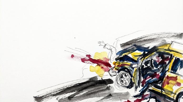
Crash Narratives
Manhattan Community Board 10: Traffic Crash Statistics
Crash Counter for Manhattan CB10 163 crashes • 0 deaths
About these crash totals
Counts come from NYC police crash reports (NYPD Motor Vehicle Collisions on NYC Open Data). We sum all crashes, injuries, and deaths for this area across the selected time window shown on the card. Injury severity follows DOT's KABCO definitions mapped from the NYPD Person table (injury status, injury type, and injury location).
- Crashes: number of police‑reported collisions (all road users).
- All injuries: people with any reported injury (KABCO A/B/C or generic "injured").
- Moderate / Serious: suspected minor + suspected serious injuries (KABCO B + A).
- Deaths: killed or apparent death reported by police (KABCO K).
Change badges (arrows and percentages) compare the selected window with the same period last year whenever we have enough history. The “From 2022” view shows totals across the full span since 2022. When a comparison window isn’t available the badge shows an em dash.
Notes: Police reports can be corrected after initial publication. We cannot verify "death within 30 days" or hospital outcomes, so small differences from DOT totals are possible. Minor incidents without a police report are not included.
CloseDangerous Schools in CB 110 Loading school hotspots...
| School | Crashes
Injuries
Child injuries
Deaths |
|---|
Dangerous Streets in CB 110 Loading street hotspots...
| Street | Crashes
Injuries
Child injuries
Deaths |
|---|
Dangerous Intersections in CB 110 Loading intersection hotspots...
| Intersection | Crashes
Injuries
Child injuries
Deaths |
|---|
Crash Finder
Try Crash Finder
Look up any street, school, address, or intersection to see how safe the streets are.
CB 110 Hot Spots Danger zones and recent crashes
Traffic Safety Timeline Tap to view recent events
Carnage in CB 110 5 Whiplash (Neck)
Crashes by Hour in CB 110 4 PM • 8 injuries →0%
Who is getting hurt? Kids 7 injuries ↑133% Seniors 7 injuries →0%
Toggle on at least one mode to see people totals.
Totals count people injured or killed. Use the mode filters above to focus the stacks.
Dangerous Bike Lanes in CB 110 Loading bike lane hotspots...
| Bike lane | Crashes
Cyclist injuries
Child injuries
Cyclist deaths |
|---|
What Crashes Cost Here Loading estimate...
Loading crash cost estimate...
The three blocks below show direct costs, other harm, and the total for crashes with injuries, crashes without injuries, and all crashes together.
How we calculate this
We calculate these costs using a method developed by the National Highway Traffic Safety Administration, or NHTSA. It gives one set of costs for crashes with injuries and another for crashes with no reported injuries.
Crashes with injuries cost much more because the method includes things like lost work, medical care, and long-term harm. NHTSA says crash costs include "lost productivity, medical, legal and court costs, emergency service, insurance administration, congestion, property damage, and workplace losses."
These are estimates, not bills. "Other harm" is the part of the broader estimate that goes beyond direct bills and insurance claims. It captures pain, disability, and lost quality of life.
Download the math (CSV) · Download the math (JSON) · Method and sources
Preventable Speeding 44 16+ offenders ↓80%
Repeat School-Zone Speeding Offenders
- ≥ 6: 108 (2026 year-to-date) • Prev: 586 2025 year-to-date
- ≥ 16: 44 (2026 year-to-date) • Prev: 215 2025 year-to-date
Pedestrian Injuries 100% by Cars and Trucks ↑85%
About this chart
We group pedestrian injuries and deaths by the vehicle type that struck them (as recorded in police reports). Use the year selector to compare the current window with the prior period.
- Trucks/Buses, SUVs/Cars, Mopeds, and Bikes reflect the broad categories we use to track vehicle harm.
- Counts include people on foot only; crashes with no injured pedestrians do not appear in this card.
Notes: Police classification can change during investigations. Small categories may have year-to-year variance.
CloseCommunity Board Contact Marquis Harrison —
Community Board Contact Marquis Harrison
District 110
Assembly Member Jordan Wright D (64)*

District 70
- 2025-06-17 · Vote · Open States · ↑ helps gradeSenate passes S 8344. School speed zone rules in New York City get extended. Lawmakers make technical fixes. The bill keeps pressure on drivers near schools. Streets stay a little safer for kids.
- 2025-06-16 · Vote · Open States · ↓ hurts gradeSenate passed S 7785. The bill carves out large Mitchell-Lama housing from bus traffic rules. Lawmakers voted yes. The carve-out weakens enforcement. Streets grow less safe for people on foot and bike.
- 2025-06-16 · Vote · Open States · ↑ helps gradeWhite Plains gets speed cameras near schools. Lawmakers move fast. Most vote yes. Cameras catch drivers who endanger kids. Program ends 2030. Streets may slow. Danger faces children every day.
- 2025-06-13 · Vote · Open StatesSenate and Assembly clear S 6815. MTA workers get a pass for driving in bus lanes while on duty. Law shields agency vehicles from tickets. Streets grow more crowded. Vulnerable users face more risk.
- 2025-02-10 · Sponsor · Open States · ↓ hurts gradeWright co-sponsors bill on autonomous vehicles, no safety impact expected.
- 2025-06-17 · Vote · Open States · ↑ helps gradeSenate passes S 8344. School speed zone rules in New York City get extended. Lawmakers make technical fixes. The bill keeps pressure on drivers near schools. Streets stay a little safer for kids.
- 2025-06-16 · Vote · Open States · ↓ hurts gradeSenate passed S 7785. The bill carves out large Mitchell-Lama housing from bus traffic rules. Lawmakers voted yes. The carve-out weakens enforcement. Streets grow less safe for people on foot and bike.
- 2025-06-16 · Vote · Open States · ↑ helps gradeWhite Plains gets speed cameras near schools. Lawmakers move fast. Most vote yes. Cameras catch drivers who endanger kids. Program ends 2030. Streets may slow. Danger faces children every day.
- 2025-06-13 · Vote · Open StatesSenate and Assembly clear S 6815. MTA workers get a pass for driving in bus lanes while on duty. Law shields agency vehicles from tickets. Streets grow more crowded. Vulnerable users face more risk.
163 W. 125th St. Suite 911, New York, NY 10027
212-866-5809
Room 532, Legislative Office Building, Albany, NY 12248
518-455-4793
Council Member Yusef Salaam A (100)*
District 9
- 2024-12-19 · Sponsor · NYC Council – Legistar · ↑ helps gradeCouncil moves to test bold pavement markings at crash sites. Five spots per borough. Focus: places where drivers have killed or maimed. Report to follow. Streets marked for danger.
- 2024-12-19 · Vote · NYC Council – Legistar · ↓ hurts gradeSalaam votes yes on bill requiring FDNY consultation for street projects.
- • Neutral2024-09-26 · Sponsor · NYC Council – LegistarCouncil bill slashes legal parking time for big rigs. Ninety minutes max for tractor-trailers. Three hours for other commercial trucks. Streets clear faster. Heavy metal moves on.
- 2024-09-26 · Vote · NYC Council – Legistar · ↑ helps gradeCouncil ends jaywalking penalties. Pedestrians now cross anywhere, any time. No summons. Law strips drivers of excuses. Streets shift. Power tilts to people on foot.
- 2024-03-07 · Sponsor · NYC Council – LegistarCouncil moves to force DOT to post clear bus lane signs on every block. Riders and walkers need to know when cars must stay out. The bill demands public, block-by-block rules. No more guessing. Streets reveal their rules.
- 2024-03-07 · Sponsor · NYC Council – Legistar · ↑ helps gradeSalaam co-sponsors resolution for unlimited subway and bus transfers.
- 2024-02-28 · Sponsor · NYC Council – LegistarCouncil moves to form a board on school crossing guard deployment. NYPD, DOT, and DOE must report twice a year. The aim: more eyes on street danger where kids cross.
- 2024-02-28 · Sponsor · NYC Council – Legistar · ↑ helps gradeCouncil bill orders speed humps on roads beside parks over one acre. DOT can skip spots if safety or rules demand. Law aims to slow cars where families walk, run, and play.
- 2025-09-25 · Sponsor · NYC Council – LegistarSalaam co-sponsors transit fare study, no immediate safety change.
- • Neutral2025-08-14 · Sponsor · NYC Council – LegistarCity orders a study of commuter vans. It will count licensed and unlicensed vehicles, map stops, and identify where vans block lanes, bus stops, and crosswalks. The report is to be published and sent to the mayor and council.
- 👎 Negative2025-08-14 · Sponsor · NYC Council – Legistar · ↓ hurts gradeA City bill forces checklist inspections and steep fines for unlicensed commuter vans. Officers must check licensure, insurance and inspections and issue maximum penalties. The law takes effect 120 days after enactment.
- 2025-06-30 · Vote · NYC Council – Legistar · ↑ helps gradeCouncil orders swift removal of abandoned, derelict cars. Streets clear in 72 hours. No plates, no stickers, no excuses. Police and sanitation must act. Safer crossings for all who walk, ride, or wait.
- 2025-02-13 · Vote · NYC Council – Legistar · ↑ helps gradeCouncil orders DOT to repaint pavement lines within five days after resurfacing. Delays must be explained to the public. Clear markings mean fewer deadly gaps for walkers and riders.
- 2026-03-10 · Sponsor · NYC Council – Legistar · ↑ helps gradeA new Council bill would force NYPD to log speed and map its crashes. The data would go up every day. Streets would show where police cars speed and where they hit.
- 2026-03-10 · Leadership · NYC Council – Legistar · ↑ helps gradeCouncil introduced Int 0780-2026. It would track NYPD vehicle speeds and map speed-limit violations and crashes, including when pedestrians are hit, hurt, or killed. The bill now sits in Public Safety.
- 2026-03-10 · Leadership · NYC Council – Legistar · ↑ helps gradeCouncil introduced Int 0780-2026. It would track NYPD vehicle speeds and map speed-limit violations and crashes, including when pedestrians are hit, hurt, or killed. The bill now sits in Public Safety.
- 2026-03-10 · Sponsor · NYC Council – Legistar · ↑ helps gradeCouncil introduced Int 0780-2026. It would track NYPD vehicle speeds and map speed-limit violations and crashes, including when pedestrians are hit, hurt, or killed. The bill now sits in Public Safety.
163 Lenox Avenue, New York, NY 10026
212-678-4505
250 Broadway, Suite 1776, New York, NY 10007
212-788-7397
State Senator Cordell Cleare A (94)

District 30
- 2022-06-01 · Vote · Open States · ↑ helps gradeAlbany passed A 8936. Cities get more state cash if they build complete streets. Lawmakers want safer roads. The bill sailed through both chambers. Money now follows safety.
- 2022-06-01 · Vote · Open States · ↓ hurts gradeAssembly and Senate passed A 8933. The bill shields emergency vehicle operators from fines for traffic violations during medical calls. Vulnerable road users face more risk. Accountability weakens. Streets grow more dangerous.
- 2022-06-01 · Vote · Open States · ↑ helps gradeCleare votes yes in committee on ignition interlock monitor bill.
- 2022-06-01 · Vote · Open States · ↑ helps gradeCleare votes yes in committee on ignition interlock monitor bill.
- 2022-03-02 · Vote · Open States · ↑ helps gradeSenate passed S 5130. The bill pushes complete street design. It aims for safe access for all. Pedestrians and cyclists get a shot at safer roads. The vote was split, but the bill moved forward.
- 2023-06-08 · Vote · Open States · ↑ helps gradeAlbany gets speed cameras near schools. Lawmakers pass A 7043. Cameras catch drivers who endanger kids. The program runs until 2028. Streets near schools face new watchful eyes.
- 2023-06-06 · Vote · Open States · ↑ helps gradeAlbany gets speed cameras near schools. Lawmakers pass A 7043. Cameras catch drivers who endanger kids. The program runs until 2028. Streets near schools face new watchful eyes.
- 2023-06-01 · Vote · Open States · ↑ helps gradeSenate passes S 6808. The bill creates first responder safety zones. It sets speed limits in these zones. Lawmakers act after crashes and close calls. The vote is strong. The danger is real. The streets demand change.
- 2023-05-31 · Vote · Open States · ↑ helps gradeSenate passes S 2714. Bill pushes complete street design. Aim: safer roads for all. Pedestrians, cyclists, and riders get space. Car dominance challenged. Lawmakers move to cut street carnage.
- 2023-02-28 · Vote · Open StatesSenate passes S 4647. Bill hikes penalties for endangering highway workers. It funds more enforcement. It pushes work zone safety awareness. Lawmakers move to protect workers from reckless drivers.
- 2023-02-13 · Vote · Open States · ↑ helps gradeAssembly and Senate passed A 602. The bill sets state funding rules for federally assisted and municipal complete street projects. Lawmakers moved fast. Streets shaped by budgets, not safety.
- 2023-02-13 · Vote · Open States · ↑ helps gradeAssembly and Senate passed A 602. The bill sets state funding rules for federally assisted and municipal complete street projects. Lawmakers moved fast. Streets shaped by budgets, not safety.
- 2023-01-31 · Vote · Open StatesCleare votes yes in committee on motor carrier safety information bill.
- 2024-06-07 · Vote · Open States · ↑ helps gradeSenate backs S 9752. Mt. Vernon gets green light for up to 20 school speed zones. Law aims to slow cars near kids. Most senators vote yes. A few say no. Streets may change. Danger remains for the young.
- 2024-06-07 · Vote · Open States · ↑ helps gradeSenate backs S 9752. Mt. Vernon gets green light for up to 20 school speed zones. Law aims to slow cars near kids. Most senators vote yes. A few say no. Streets may change. Danger remains for the young.
- 2024-06-06 · Vote · Open States · ↑ helps gradeLawmakers back speed cameras near Kingston schools. Cameras catch drivers who speed. The bill passed both chambers. It sunsets in 2029. Children and families walk safer, but the fix is temporary.
- 2024-06-06 · Vote · Open States · ↑ helps gradeLawmakers back speed cameras near Kingston schools. Cameras catch drivers who speed. The bill passed both chambers. It sunsets in 2029. Children and families walk safer, but the fix is temporary.
- 2024-03-14 · Vote · Open StatesCleare votes yes on Senate budget resolution, no safety impact noted.
- 2024-03-14 · Vote · Open StatesCleare votes yes on Senate budget resolution, no safety impact noted.
- 2024-03-05 · Sponsor · Open StatesCleare sponsors bill requiring rear occupant alert systems in vehicles.
- 2024-02-13 · Vote · Open States · ↑ helps gradeSenate passes S 2714. Bill pushes complete street design. Aim: safer roads for all. Pedestrians, cyclists, and riders get space. Car dominance challenged. Lawmakers move to cut street carnage.
- 2025-06-13 · Vote · Open States · ↑ helps gradeSenate passes S 8344. School speed zone rules in New York City get extended. Lawmakers make technical fixes. The bill keeps pressure on drivers near schools. Streets stay a little safer for kids.
- 2025-06-12 · Vote · Open States · ↑ helps gradeSenate backs S 4045. Repeat speeders face forced installation of speed assistance tech. Eleven points or six camera tickets triggers action. Law targets reckless drivers. Streets may get safer for those outside the car.
- 2025-06-12 · Vote · Open States · ↑ helps gradeSenate passes S 8344. School speed zone rules in New York City get extended. Lawmakers make technical fixes. The bill keeps pressure on drivers near schools. Streets stay a little safer for kids.
- 2025-06-12 · Vote · Open States · ↑ helps gradeS 7955 moved in the Senate. It ties school bus stop‑arm cameras to how tickets get judged. The aim is enforcement around stopped school buses.
- 2025-01-28 · Sponsor · Open StatesCleare sponsors bill requiring rear occupant alert systems in vehicles.
- 2025-01-08 · Sponsor · Open StatesSenate bill S 131 demands complete street design for state-funded projects. Sponsors push for safer roads. Guidance will go public. Streets could change. Pedestrians and cyclists stand to gain.
- 2025-06-13 · Vote · Open States · ↑ helps gradeSenate passes S 8344. School speed zone rules in New York City get extended. Lawmakers make technical fixes. The bill keeps pressure on drivers near schools. Streets stay a little safer for kids.
- 2025-06-12 · Vote · Open States · ↑ helps gradeSenate backs S 4045. Repeat speeders face forced installation of speed assistance tech. Eleven points or six camera tickets triggers action. Law targets reckless drivers. Streets may get safer for those outside the car.
- 2025-06-12 · Vote · Open States · ↑ helps gradeSenate passes S 8344. School speed zone rules in New York City get extended. Lawmakers make technical fixes. The bill keeps pressure on drivers near schools. Streets stay a little safer for kids.
- 2025-06-12 · Vote · Open States · ↑ helps gradeS 7955 moved in the Senate. It ties school bus stop‑arm cameras to how tickets get judged. The aim is enforcement around stopped school buses.
Adam Clayton Powell, Jr. State Office Building 163 W. 125th St., Suite 912, New York, NY 10027
212-222-7315
Room 905, Legislative Office Building, Albany, NY 12247
518-455-2441
Other Geographies See nearby areas
▸ Other Geographies
Manhattan CB 10 Manhattan Community Board 10 sits in AD 70, Manhattan, District 9, Precinct 32, SD 30.
It contains Harlem (South), Harlem (North).